
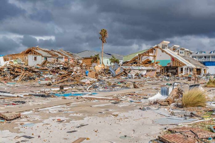
When a Category 5 hurricane stays just offshore, the danger often multiplies rather than recedes; Polo’s forecast track near Baja California Sur brings the full spectrum of hurricane hazards—surge, destructive surf, torrential rain, and damaging wind—without the false comfort of a clean, single landfall point.
The Short Version
- The National Hurricane Center forecasts Polo to approach Baja California Sur as a hurricane on Monday; a Hurricane Watch is in effect for parts of the peninsula.
- Impacts extend far beyond the eyewall: life-threatening surf, rip currents, coastal flooding, and heavy rain are all likely along Mexico’s Pacific coast and Baja.
- Track guidance emphasizes an offshore or nearshore path, but hydrologic impacts—flooding, mudslides—can be severe even without a direct landfall.
- Preparation time is short: tropical-storm-force winds can arrive before the core, complicating last-minute efforts.
What the forecast says—watches, timing, and hazards
The most direct message from forecasters is unambiguous: Polo is expected to be a hurricane as it approaches the west coast of the Baja California peninsula on Monday. The National Hurricane Center has issued a Hurricane Watch for portions of Baja California Sur, a formal heads-up that hurricane conditions are possible within the watch area, typically within 48 hours. Additional watches may be needed on the peninsula’s east coast as guidance converges on how closely the core tracks the shoreline. That lead time matters because tropical-storm-force winds can begin well before the center arrives, making final preparations risky or impossible; the NHC is explicit that conditions on Monday could complicate further protective action.
Beyond wind, the risk profile includes heavy rainfall, storm surge in vulnerable coastal inlets, and a long fetch of destructive swell. Rain bands will begin impacting Baja California Sur as early as late Sunday into Monday with the potential for flash flooding and debris flows in steep terrain. Even if the eye remains offshore, the NHC’s marine and tropical discussions outline seas building into the high teens to 20s in feet over the offshore waters, with swells propagating north along the coast—conditions that support dangerous surf, life-threatening rip currents, and coastal inundation at high tide windows.
Why “offshore” does not mean “safe”—the mechanism of coastal risk
Eastern Pacific hurricanes frequently travel parallel to Mexico’s coastline before bending northwest toward Baja, keeping the center just offshore yet spreading impacts across a wide arc. The wind field and pressure gradient drive long-period swells and storm surge that push water into bays and low-lying communities, while outer rainbands scrape the coastal mountains. Those mountains act like a rainfall amplifier: moist inflow is forced upslope, intensifying precipitation and turning 4–8 inches of basin-average rain into locally higher totals on ridgelines and canyon catchments. The result is a familiar but often underappreciated hazard sequence—flash flooding, mudslides, and road washouts—especially where soils are thin and slopes are steep.
This is the false binary the public often inherits from the Saffir–Simpson conversation: wind dominates headlines, but water does much of the damage. Polo fits the pattern. Official guidance flagged powerful surf and rip currents along the southwestern mainland days ahead of any Baja approach; as the storm arcs north, that sea state spreads up the peninsula and then modulates slowly as the system weakens and swells decay. Meanwhile, any nearshore pass can still produce damaging onshore wind bursts and localized surge in embayments—enough to threaten marinas, low bridges, and coastal roads even without the eye crossing the beach.
How we got here—intensity, track, and the watch/warning logic
Polo’s intensity episode—periods at Category 5 strength—owes to exceptionally warm sea-surface temperatures and a deep reservoir of oceanic heat enabling rapid intensification. But for emergency managers and the public, the critical piece is the track evolution and the NHC’s watch/warning framework that translates forecast confidence into action cues. A Hurricane Watch signals the plausible arrival of hurricane conditions within about two days, prompting protective steps that take time: securing boats, clearing drains, staging generators, and pre-positioning medical and public safety resources. If confidence increases, a Hurricane Warning may follow, generally within 36 hours of expected onset, at which point movement becomes constrained by the very winds you’re preparing for. That sequencing is exactly why the NHC emphasizes that Monday’s onset of tropical-storm-force winds could make “further preparations difficult”.
Track guidance in the Eastern Pacific often features a northwestward turn as steering flow shifts around the subtropical ridge. For Baja California Sur, that means a glancing, nearshore pass can be as consequential as a landfall in practical terms: the right-front quadrant’s onshore winds, higher seas, and heaviest rain are favored along and just to the east of the track. Even modest wobbles—tens of miles—can change which coastal communities see the most severe conditions. That inherent envelope of uncertainty underpins why watches may expand to the east coast of the peninsula as confidence firms up.
What to prioritize—preparation that matches the real risks
For households and businesses, hazard-specific preparation beats generic checklists. On the wind side, secure rooftop equipment, signage, and solar panels; bring in or lash down outdoor furniture. For water, clear roof drains and street grates, elevate critical equipment above expected high-water marks, and review evacuation routes that avoid low-lying causeways susceptible to wave-driven overwash. Mariners should assume limited safe window: move vessels to sheltered basins early, double up mooring lines with chafe protection, and strip canvas. Along open coastlines, heed local closures; large, long-period swell arrives before the core and lingers after, making “between-bands” beach activity deceptively dangerous.
Municipal operators should pre-stage barricades at recurrent flood points, verify redundancy for power and communications, and check pump stations for uninterrupted runtime. In mountain foothills and canyon communities, target communication to landslide-prone corridors and emphasize the timing asymmetry: rainfall hazards can peak after the strongest winds have passed. Finally, calibrate expectations—if the watch becomes a warning, mobility drops quickly as winds rise and surf overtops vulnerable crossings. The safest plan is the one completed before the first gale gust, not during it.
2 PM Top-of-the-Hour News
Millions of people on both coasts are dealing with extreme weather this weekend, with a nor'easter sending wind and rain up and down New England and the Mid-Atlantic … and Hurricanes Nolo and Polo affecting Hawaii and Mexico.
NewsNation's Marcus… pic.twitter.com/i8xJ0HnAhn— Worldwide News Network (@WorldwideNNX) September 26, 2026
The road ahead—what to watch as Polo nears Baja
Over the next 24–48 hours, three signals will determine the magnitude and focus of impacts. First, any eyewall replacement cycles that temporarily lower peak winds can expand the storm’s size, broadening the field of strong winds and increasing surge potential despite a dip in the headline category. Second, the exact angle of approach relative to the peninsula’s coastline will govern where the right-front quadrant sets up; a track ten to twenty miles closer to shore substantially raises the risk envelope for onshore wind and surge. Third, the phasing of peak swell with local high tides will dictate coastal flooding severity—watch local tide tables as closely as wind speed numbers.
The guidance suite and official bulletins are aligned on the core message: Polo is a dangerous hurricane that will approach Baja California Sur on Monday with the capacity to produce destructive surf, flooding rain and mudslides, coastal inundation, and damaging winds across parts of northwestern Mexico, regardless of whether the eye crosses the coastline. Treat the watch as a last clear signal to finish preparations, and follow local emergency management instructions as conditions deteriorate.
Sources:
feedpress.me, nhc.noaa.gov, va.gov, reuters.com, english.elpais.com